Backroad Mapbooks (BRMB) – Northwest Ontario – 5th Edition

Map Features: Highways, Logging Roads, Land & Water Features, Parks, Adventure Points of Interest, Campgrounds, Hiking Trails, Motorized Trails, Paddling Routes, Hunting & Fishing Areas, Winter Recreation and more

Areas Covered: Chapleau, Cobalt, Cochrane, Elliot Lake, Foleyet, French River, Gogama, Gowganda, Hearst, Kapuskasing, Kirkland Lake, Manitoulin Island, Matchewan, Moosonee, North Bay, Sault Ste. Marie, Sudbury, Temagami, Temiskaming Shores, Timmins, Wawa, & more

Northeastern Ontario is a sprawling region that encompasses much of the Canadian Shield, boasting gorgeous vistas of granite rock, boreal forest and thousands of lakes. Shaped by ancient glacial activity, this wild landscape is full of interconnected streams and rivers, while heading north leads you to the remote and rugged land around Hudson Bay. From the sparkling waters of Georgian Bay to the northern backcountry of Polar Bear Provincial Park, outdoor explorers can enjoy a wealth of opportunity in this sparsely-populated region. To help you better explore Northeastern Ontario, the Backroad Mapbooks team has created the most comprehensive and detailed recreation Mapbook for the region ever!

Category: Tags: ,

Description

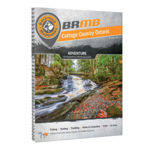
BRMB’s classic printed Backroad Mapbooks have been guiding outdoor adventures of all shapes and sizes through the Canadian Backcountry for over a quarter century. These durable, spiral-bound 21.5 x 28 cm (8.5 x 11 in) Mapbooks provide you with industry leading cartographic detail and topographic relief, unparalleled road and trail coverage, thousands of adventure POIs and tons of adventure information, from camping to fishing, hunting, hiking, ATVing and beyond. No other recreation maps offer this level of detail or this amount of adventure information, with complete coverage from the coast of BC to the shores of Newfoundland.